Skip to content

Bathymetric Surveys

We conduct hydrographic surveys using state-of-the-art survey equipment and the most stringent quality-control standards required by U.S. Army Corps of Engineers for federal navigation projects. We are experienced at establishing tidal datums and North American Vertical Datum of 1988 conversions using National Oceanic and Atmospheric Administration-approved methods.

Contact Information

Get in Touch

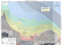
We conduct hydrographic surveys to create bathymetric contour maps for multiple purposes, including navigation safety, pre- and post-dredge inspections, lake and reservoir volume computations, and site assessments. Bathymetric surveys use:

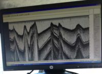
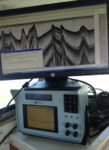
  • Single-beam or multibeam depth finders to measure water depth
  • Towed side-scan sonars for images of seafloor objects
  • Global positioning system navigation for horizontal positioning
Contact Us

Get In Touch


    This site is protected by reCAPTCHA and the Google Privacy Policy and Terms of Service apply.

    This website requires cookies to provide all of its features. For more information on what data is contained in the cookies, please see our Privacy Policy page. By continuing to use this website, you agree to our Privacy Policy.